Guide de randonnées (en anglais) - Glyndwr's Way from Knighton to Welshpool | Cicerone

Guide de randonnées (en anglais) - Glyndwr's Way from Knighton to Welshpool | Cicerone guide de randonnée Cicerone

Guide de randonnées (en anglais) - Glyndwr's Way from Knighton to Welshpool | Cicerone

Prix régulier 16,95 €
/
  • Expédition sous 24 h ouvrées depuis notre entrepôt en France
  • Frais de livraison calculés instantanément dans le panier
  • Retours gratuits (*)
  • Stocks en temps réel
  • En stock
  • Inventaire sur le chemin
Taxes incluses.

Souvent achetés ensemble :

Topoguide (en anglais) de l'éditeur Cicerone.
Description fournie par l'éditeur :
Guidebook to walking Glyndwr's Way, a long-distance National Trail through mid-Wales. The 135 mile route from Knighton via Machynlleth to Welshpool takes 9 days to walk, and 2 days (29 miles) to complete the loop down the Offa's Dyke Path to create a circular trail. A lovely trail through quiet hills, forests and rolling countryside.
Seasons : Spring, summer and autumn are ideal for walking; winter can be a problem if there is deep snow; after prolonged rain some parts can be muddy
Centres : Knighton, Llangunllo, Felindre, Llanbadarn Fynydd, Abbeycwmhir, Llanidloes, Dylife, Machynlleth, Cemmaes Road, Llanbrynmair, Llangadfan, Llanwddyn, Dolganog, Meifod, Welshpool, Montgomery.
Difficulty : Suitable mainly for long-distance walkers; essentially hill country, with lots of ascents and descents, but also many gentle and easy stretches; careful attention to waymarking is required and accommodation is sparse in some places.
Must See : Quiet and remote mid-Wales countryside, links with the Offa's Dyke Path, Abbeycwmhir ruins, Llyn Clywedog, Dylife mines, Parliament House at Machynlleth, Dyfnant Forest, Llyn Efyrnwy, Ann Griffiths Walk, Powis Castle.


ISBN/EAN : 9781852849504
Date de publication : 2018
Dimensions plié(e) : 12 x 17 cm
Langue(s) : anglais
Poids : 201 g

Customer Reviews

No reviews yet
0%
(0)
0%
(0)
0%
(0)
0%
(0)
0%
(0)
Beau livre - Les plus belles randos en Grande-Bretagne - Édition 2021 | Lonely Planet beau livre Lonely Planet
Beau livre - Les plus belles randos en Grande-Bretagne | Lonely Planet
Lonely Planet EN
21,00 €
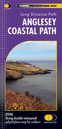
Carte de randonnée - Anglesey Coastal Path XT40 | Harvey Maps - National Trail maps carte pliée Harvey Maps
Carte de randonnée - Anglesey Coastal Path XT40 | Harvey Maps - National Trail maps
Harvey Maps
22,95 €
Carte de randonnée - Brecon Beacons Est XT25 | Harvey Maps - Superwalker maps carte pliée Harvey Maps
Carte de randonnée - Brecon Beacons Est XT25 | Harvey Maps - Superwalker maps
Harvey Maps
21,95 €
Carte de randonnée - Brecon Beacons Est XT40 | Harvey Maps - Ultramap carte pliée Harvey Maps
Carte de randonnée - Brecon Beacons Est XT40 | Harvey Maps - Ultramap
Harvey Maps
16,95 €
Carte de randonnée - Brecon Beacons Ouest XT25 | Harvey Maps - Superwalker maps carte pliée Harvey Maps
Carte de randonnée - Brecon Beacons Ouest XT25 | Harvey Maps - Superwalker maps
Harvey Maps
21,95 €
Vu récemment