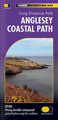
Carte de randonnée - Wales Coast Path 1 XT40 | Harvey Maps - National Trail maps

Prix
Prix régulier 26,40 €
Prix régulier Prix réduit 26,40 €
Écomisez -26,40 €
/
  • Expédition sous 24 h ouvrées depuis notre entrepôt en France
  • Frais de livraison calculés instantanément dans le panier
  • Retours gratuits (*)
  • Stocks en temps réel
  • En stock
  • En rupture de stock, expédition prochainement
Taxes incluses.

Souvent achetés ensemble :

Carte de randonnée éditée par Harvey Maps idéale pour découvrir les sentiers nationaux de Grande Bretagne.


Description originale de l'éditeur :
Wales Coast Path map 1 including Anglesey Coastal Path

The Wales Coast Path is a 1400km (870 miles) long distance trail that follows, or runs close to, the entire coastline of Wales. It is an incredibly varied trail that offers rugged and unspoilt walking, colourful seaside villages, industrial archaeology, clifftops, beaches and unique heritage sites.

4 HARVEY maps cover the whole of the route. Each map covers a section of the Path suitable for about 2 weeks of walking.

Map 1 covers the Path from the start in Chester to Caernarfon, and includes the whole of the Anglesey Coastal Path.

From Chester, just across the border in England, you will walk a short distance to the border and the official start of the Wales Coast Path. Heading west across North Wales, you will pass through bustling seaside towns and sandy beaches, before reaching the Menai Strait and the island of Anglesey.


ISBN/EAN : 9781851376605
Date de publication : 2023
Echelle : 1 / 40 000 (1 cm = 400 m)
Impression : recto
Dimensions plié(e) : 11,6 x 24,3 cm
Dimensions déplié(e) : 69,6 x 97,2 cm
Langue(s) : anglais
Poids : 70 g

Customer Reviews

Be the first to write a review
0%
(0)
0%
(0)
0%
(0)
0%
(0)
0%
(0)