Carte pliée du ciel nocture, vu de l'hémisphère nord (en anglais).
Cette carte est imperméable et résistante au déchirement.
Description de l'éditeur :
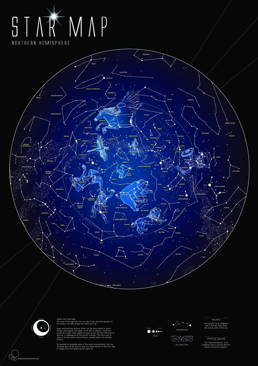
Every culture has drawn pictures in the stars, creating constellations that represent animals or mythic figures. Ancient astronomers peered into the night sky and imagined glittering jewels set in a crystal sphere slowly revolving around the Earth from east to west. The 88 constellations recognized today by the International Astronomical Union (IAU) are not just pictures but basic units that partition the sky.
The Night Sky - Northern Hemisphere Stargazer Map and Guide is centered on Polaris, the North Star, which appears fixed in place with the other stars on the chart rotating around it. Thus it has long aided navigators in determining both direction and latitude. The constellations and brighter stars are labeled with their latin names.
The map includes a table of star magnitude or brightness. As the Earth moves in its orbit around the Sun the constellations in the sky change. The Night Sky map includes four seasonal charts that are specific for each season: spring, summer, autumn, and winter.
Every Stargazer Map is printed on durable synthetic paper, making them waterproof, tear-resistant and tough — capable of withstanding the rigors of repeated outdoor use.